
Mapping has gotten so much better since I started working on maps in 2004. The quality of venue data has improved. Road data has improved. We have real-time traffic. The overall detail provided has improved – Apple even shows trees.
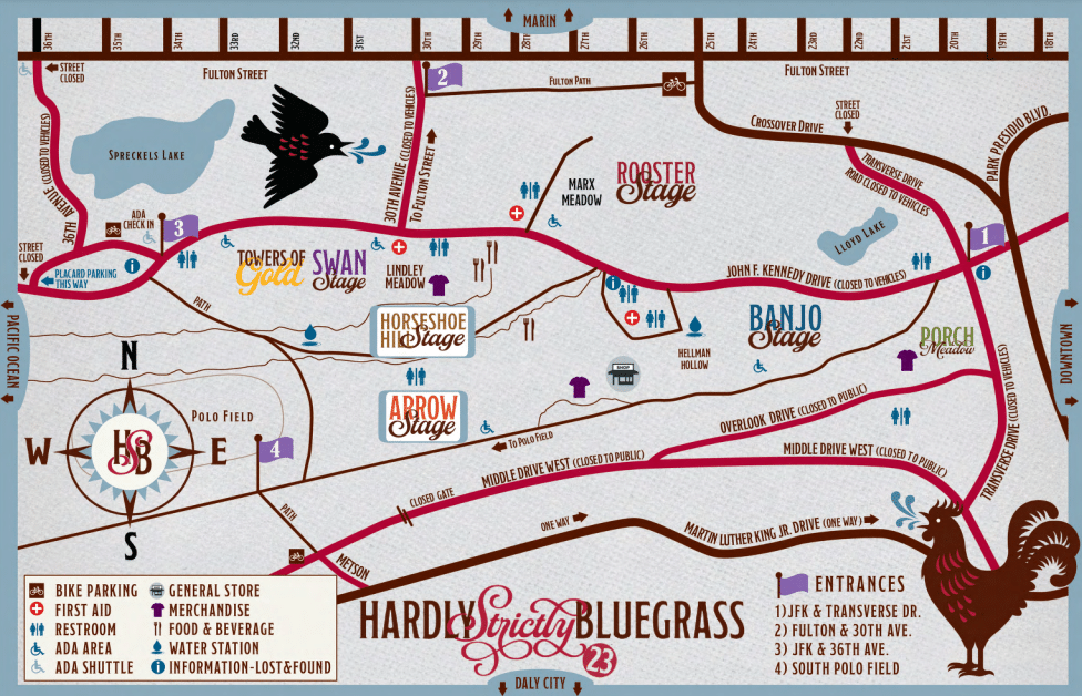
One important thing that hasn’t improved: temporary events. I went to the Hardly Strictly Bluegrass festival over the weekend. The organizers put together the terrible map above.
When I search for “hardly strictly bluegrass” on Google Maps, I get this:

(The pin doesn’t match my search term because apparently Google is pulling the text from a description of Hellman Hollow.)
I’ve got two maps: one that I can use for walking and directions and one that gives me a sense of what’s going on at the festival.
What I need is to marry the two. I want to route (using transit, walking, etc.) via the mapping tools I use normally but still know the details of my temporary event.
It starts from the very beginning: I had a very hard time finding the entrance gates because the event map was zoomed in too far to show the entrances to the park.
Given the source map from the venue, you could marry the roads with the roads in the digital map.
This approach would be useful for concerts, music festivals, marathons and other events. Bonus points for identifying road closures to keep traffic from getting snarled.
